

Geoimage Survey
Surveyors in Business Bay - Dubai - UAE
Precision Geospatial Surveying & Mapping Solutions in Dubai, UAE
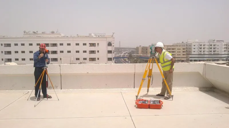
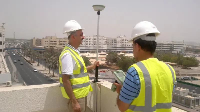
Welcome to Geoimage Survey, your premier partner for advanced geospatial survey services in Dubai and across the UAE. We specialize in collecting, analyzing, and interpreting complex geospatial data to empower informed decision-making across various critical industries. Utilizing cutting-edge aerial platforms, including advanced drones and state-of-the-art remote sensing technologies such as LiDAR data capture, we provide unparalleled accuracy for high-resolution imagery, detailed mapping, comprehensive land monitoring, and precise environmental assessments.
Our expertise extends to supporting major projects in real estate development, construction, and infrastructure planning throughout Dubai and the surrounding Emirates. We deliver precise spatial information tailored for urban planning, asset management, and crucial site analysis. At Geoimage Survey, our commitment is to provide actionable insights derived from meticulous data collection and expert analysis, ensuring your projects benefit from the most reliable and efficient GIS solutions in Dubai. Trust us for innovative and comprehensive surveying services that transform raw data into strategic advantages for your business.
Why Choose Geoimage Survey in Dubai?
- Cutting-Edge Technology & Innovation
We employ the latest drone surveying, LiDAR, and remote sensing technologies to deliver superior data quality and efficiency for all your spatial data needs in Dubai. - Unrivaled Accuracy & Detail
Our commitment to precision ensures that every geospatial survey provides highly accurate and detailed spatial information, critical for successful project execution in the UAE. - Comprehensive Service Portfolio
From precise land monitoring and detailed mapping to advanced 3D modeling and intricate environmental assessments, we offer a full spectrum of services tailored for various industries. - Expert Geospatial Specialists
Our highly skilled team of geospatial experts possesses extensive experience and local knowledge, guaranteeing professional and reliable results for every project in Dubai. - Strategic Dubai & UAE Focus
With a deep understanding of local regulations, development trends, and specific project requirements in Dubai and the broader UAE, we deliver localized and effective solutions. - Data-Driven Decision Making
We transform complex geospatial data into clear, actionable insights, empowering our clients to make smarter, more informed decisions for their real estate and infrastructure ventures. - Efficiency & Timeliness
Leveraging advanced techniques, we deliver high-quality survey results promptly, helping you keep your projects on schedule and within budget across the UAE.
What core services does Geoimage Survey offer in Dubai?
Geoimage Survey specializes in comprehensive geospatial survey services in Dubai, including drone surveying, LiDAR data capture, high-resolution imagery, land monitoring, mapping, 3D modeling, and environmental assessments for various industries.
How does drone surveying benefit my construction or real estate project in Dubai?
Our drone surveying services in Dubai provide rapid, cost-effective, and highly accurate spatial data, enabling precise site analysis, progress monitoring, volume calculations, and detailed mapping crucial for real estate development and construction projects.
What is LiDAR technology and how does Geoimage Survey utilize it?
LiDAR (Light Detection and Ranging) is a remote sensing method used to examine the surface of the Earth. Geoimage Survey uses LiDAR mapping in Dubai to generate highly accurate 3D point clouds, digital elevation models, and detailed terrain mapping, essential for infrastructure and urban planning.
Which industries does Geoimage Survey cater to in the UAE?
We serve a wide range of industries across the UAE, including real estate, construction, infrastructure development, urban planning, environmental management, agriculture, and utility companies, providing specialized geospatial solutions.
How accurate are your geospatial surveys and data analysis?
Geoimage Survey is committed to delivering unparalleled accuracy. We employ advanced technology and rigorous methodologies to ensure our geospatial data and analysis meet the highest industry standards, providing reliable insights for critical decisions in Dubai.
What is the typical process for requesting a survey from Geoimage Survey?
To request a geospatial survey in Dubai, simply contact us with your project requirements. Our team will assess your needs, provide a detailed proposal, and upon approval, schedule and execute the survey using our advanced equipment, followed by data processing and delivery.
Do you offer 3D mapping and modeling services for urban development in Dubai?
Yes, we provide advanced 3D mapping and modeling services in Dubai, creating highly detailed and accurate digital representations of terrains, buildings, and infrastructure. This is invaluable for urban planning, visualization, and facility management.
What geographic areas in Dubai and the UAE do you cover for your services?
Geoimage Survey provides comprehensive geospatial services across all of Dubai and extends our operations throughout the entire United Arab Emirates, covering various Emirates and districts, including Business Bay and beyond.
Can Geoimage Survey assist with environmental impact assessments or monitoring?
Absolutely. We offer specialized services for environmental assessments and monitoring, utilizing remote sensing data and drone technology to collect crucial information on land cover changes, vegetation health, and other ecological parameters across the UAE.
What makes Geoimage Survey a preferred choice for geospatial services in Dubai?
Clients choose Geoimage Survey for our blend of cutting-edge technology, highly accurate data, expert team, localized knowledge of Dubai and UAE regulations, and our commitment to delivering efficient, actionable GIS solutions that drive project success.
Rate us and Write a Review

 Your request has been submitted successfully.
- SundayDay Off
- Monday09:00 AM - 06:00 PM
- Tuesday09:00 AM - 06:00 PM
- Wednesday09:00 AM - 06:00 PM
- Thursday09:00 AM - 06:00 PM
- Friday09:00 AM - 06:00 PM
- Saturday09:00 AM - 03:00 PM
June, 2026
Sunday
August 26,2019
- Tuesday
- 9:00am - 10:00am
Awesome Job!
We have received your appointment and will send you a confirmation to your provided email upon approval.
 Own or work here?
