


Falcon Survey Engineering Consultants
Surveyors in Dubai Silicon Oasis - Dubai - UAE
Precision Land Surveying & Advanced Geospatial Services in Dubai
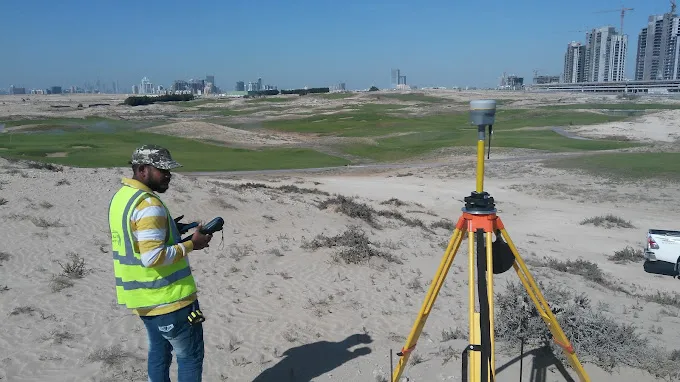
Discover unparalleled accuracy and efficiency with Falcon Survey Engineering Consultants, a leading surveying and mapping company in Dubai, UAE. Established in 2007, we specialize in delivering cutting-edge geospatial solutions crucial for modern development across the Emirates. Our expertise lies in utilizing state-of-the-art technologies, including advanced drone surveying in Dubai, to provide comprehensive data for a wide array of projects. From intricate land development surveys to large-scale infrastructure mapping, our services ensure precision and reliability, setting the benchmark for professional land surveyors in Dubai.
At Falcon Survey Engineering Consultants, we harness the power of Unmanned Aerial Vehicles (UAVs) equipped with high-resolution cameras, LiDAR scanners, and advanced GPS receivers. This allows us to capture detailed aerial imagery and accurate LiDAR data efficiently over vast and complex terrains. Whether it’s for construction site monitoring, precise mapping of infrastructure projects, meticulous urban planning in Dubai, or critical environmental surveys, our drone technology ensures superior data collection, reducing project timelines and enhancing analytical capabilities. Trust our experienced team for superior geospatial data acquisition and analysis across the region, serving critical sectors in Dubai Silicon Oasis and beyond.
Why Choose Falcon Survey Engineering Consultants in Dubai?
- Cutting-Edge Drone Technology
We utilize the latest drones equipped with high-resolution cameras and LiDAR scanners for unparalleled data accuracy and efficient collection across all project types. - Expert Geospatial Solutions
Benefit from our comprehensive suite of geospatial services, including detailed aerial imagery, LiDAR data acquisition, and precise 3D mapping for complex projects in Dubai. - Proven Industry Experience
Established in 2007, Falcon Survey Engineering Consultants brings over a decade of local expertise, delivering reliable and accurate surveying and mapping services across the UAE. - Precision & Accuracy Guaranteed
Our commitment to advanced methodologies and stringent quality control ensures the highest level of precision for all your land surveying and mapping needs in Dubai. - Tailored Project Support
We offer customized surveying and mapping solutions, adapting our services to meet the unique requirements of your construction, infrastructure, or environmental project in Dubai. - Efficiency & Timely Delivery
Leveraging drone technology, we significantly reduce data collection times and expedite project completion, providing you with critical information faster. - Comprehensive Data Analysis
Beyond data acquisition, we provide insightful analysis and reporting, transforming raw geospatial information into actionable intelligence for informed decision-making.
What types of surveying services does Falcon Survey Engineering Consultants offer in Dubai?
We offer a comprehensive range of land surveying and geospatial services including topographic surveys, cadastral surveys, construction surveys, hydrographic surveys, and utility mapping, all enhanced by advanced drone technology in Dubai.
How does Falcon Survey Engineering Consultants utilize drones for surveying?
Our drones are equipped with high-resolution cameras, LiDAR sensors, and GPS receivers to capture detailed aerial imagery and LiDAR data. This enables efficient and accurate data collection for 3D modeling, volume calculations, and site monitoring in Dubai.
Which areas in the UAE do you serve for surveying and mapping projects?
While based in Dubai (specifically Dubai Silicon Oasis), Falcon Survey Engineering Consultants provides geospatial solutions and drone surveying services across all Emirates, including Abu Dhabi, Sharjah, Ajman, RAK, Umm Al Quwain, and Fujairah.
What are the benefits of using drone surveying compared to traditional methods?
Drone surveying offers significant advantages, including faster data acquisition, access to difficult terrains, enhanced safety, higher data resolution, and cost-effectiveness for large-scale mapping and inspection projects in Dubai.
Can your services support large-scale infrastructure projects in Dubai?
Absolutely. We specialize in providing precise geospatial data and surveying support for major infrastructure projects in Dubai, including roads, utilities, pipelines, and urban development, ensuring accurate planning and execution.
How accurate is the data collected by your drone surveying methods?
We employ state-of-the-art drones and advanced processing software to ensure high data accuracy, often achieving centimeter-level precision, which is critical for engineering and construction projects in Dubai.
Do you offer services for environmental monitoring and analysis?
Yes, our drone surveying capabilities are ideal for environmental monitoring, including habitat mapping, erosion tracking, and change detection, providing valuable data for sustainability and conservation efforts across the UAE.
How can I request a consultation or a quote for a surveying project in Dubai?
You can easily request a consultation or a detailed quote by visiting our website, sending an email to info@falconsurveyme.com, or calling us directly at +97143271414. Our team, located in Dubai Silicon Oasis, is ready to discuss your specific geospatial needs in Dubai.
What kind of projects commonly utilize your LiDAR data services?
Our LiDAR data services in Dubai are frequently used for detailed topographic mapping, precise volume calculations, utility corridor mapping, urban modeling, and forestry applications, offering unparalleled elevation accuracy.
Are your surveyors licensed and certified in Dubai?
Yes, Falcon Survey Engineering Consultants operates with fully licensed and highly certified land surveyors in Dubai and the UAE, adhering to all local regulations and international best practices for professional surveying.
Rate us and Write a Review
 Your request has been submitted successfully.
- Closed Now09:00 AM - 03:00 PM
- Monday09:00 AM - 06:00 PM
- Tuesday09:00 AM - 06:00 PM
- Wednesday09:00 AM - 06:00 PM
- Thursday09:00 AM - 06:00 PM
- Friday09:00 AM - 06:00 PM
- Saturday09:00 AM - 03:00 PM
June, 2026
Saturday
- Closed Now
August 26,2019
- Tuesday
- 9:00am - 10:00am
Awesome Job!
We have received your appointment and will send you a confirmation to your provided email upon approval.
 Own or work here?
